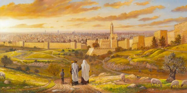
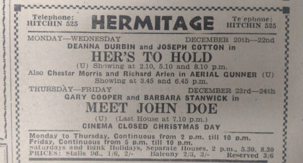
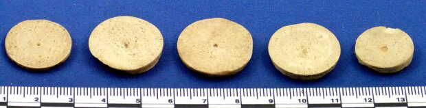
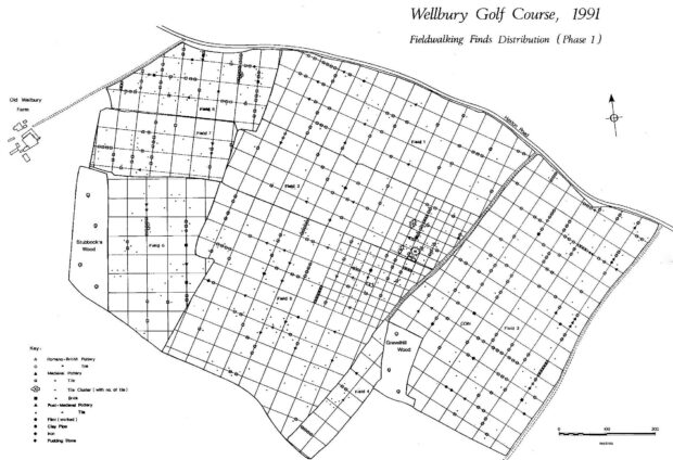
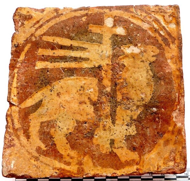
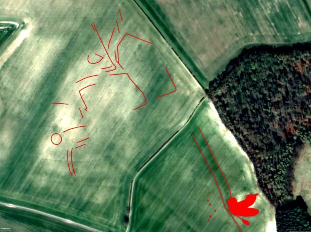
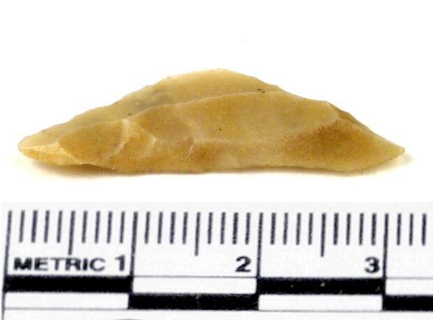
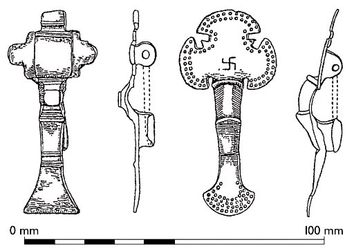
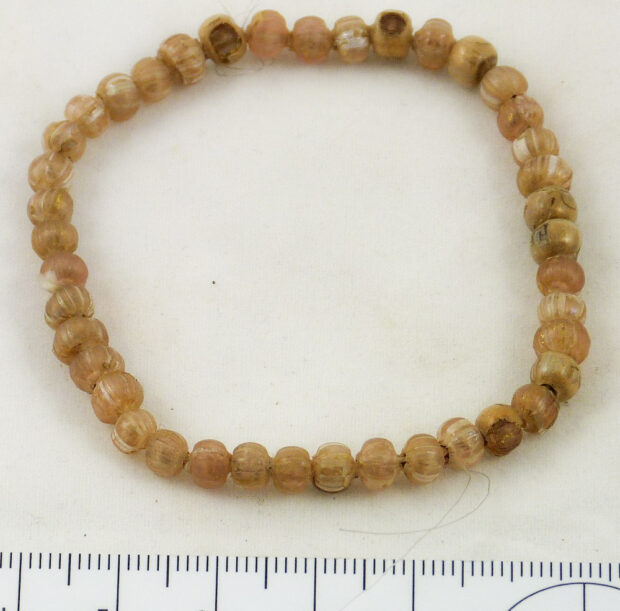
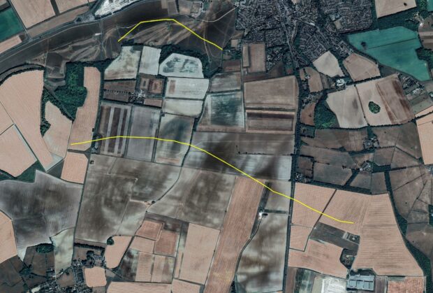
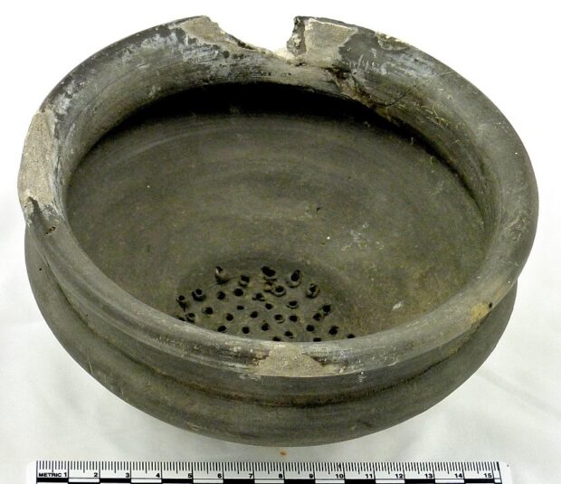
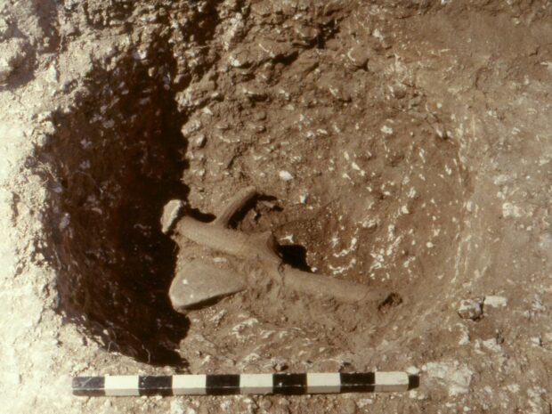
1 3 4 5 6 7 74

The discovery of Roman Baldock happened after Mr Hart, the farmer of Walls Field, ploughed up a human skull just before Easter in 1925. Over the next five years, Percival Westell of Letchworth Museum and his assistants excavated over 450 burials from a cemetery, or possibly two adjacent cemeteries. The burials were mostly undamaged by later ploughing, as they lay towards the bottom of a slope and soil washed downhill had protected them for many centuries.

Because of the excellent preservation, they provided Westell with a vast haul of objects to put into the growing Letchworth Museum. Although he published his results promptly, as a result of which the cemetery is well known among archaeologists, his standards were poor and his record keeping almost non-existent. We don’t even have a plan of the cemetery showing the locations of individual burials, let alone plans of the graves themselves. He did keep everything from a single burial together most of the time, though, so we can reconstruct from his ‘burial groups’ the contents if not the layout of each one.

Most of the burials in the cemetery were of cremated remains, which can be dated from the mid first century AD through to the late third because most of them contained datable pots. There were also inhumation burials, represented by skeletons; although Westell kept their skulls and sent them to the Royal College of Surgeons, they were destroyed by bombing during the Blitz along with the rest of the College’s collection. They are less easy to date than the cremations, although some contained pottery disturbed from earlier graves. Westell’s initial dating of the pottery was often wrong, and a 1985 dissertation by Maria Fabrizi, an undergraduate of the University of Bradford, was able to suggest more accurate dates.

Westell did not excavate the entire cemetery, as trenches by his assistant Erik Applebaum in the early 1930s uncovered more inhumation graves. It is also evident from his inadequate plan that the burials concentrated in two principal groups: one to the north-east and one to the south-west of the area he excavated. Using Fabrizi’s dating, we can see that the earliest burials in the southwestern group date from about AD 50-70, while the latest belong to the early third century. The 53 inhumation burials in this part of the site cannot be dated, unfortunately. The earliest burials in the northeastern are later, about AD 75-100, and deposition here continued into the fourth century. These distinct but overlapping date ranges make it likely that we are indeed looking at two separate burial grounds.

Westell retained very few cremated human remains: there is an account by his assistant J Peat Young of them tipping the remains out onto the field surface as being of no value! Nor did he record the positions of vessels in cremation pits or the alignments of bodies in individual inhumations. The majority were aligned with head to the west, although some had heads to the south; most were extended, but some seem to have been crouched.

One of the burials in the northeastern group (Westell’s Group 89), excavated in spring 1928, contained cremated bone inside a decorated samian bowl of form Dragendorff 37. The bowl came from the potteries at Lezoux in Central Gaul (Puy-de-Dôme, France), and bears the stamps SACRILLIM (Sacrillus’s Manufactory) and DOECCVS (Doeccus, the name of the artist who created the decoration). Doeccus’s decoration consists of an image of Silenus with a basket of fruit on his head, a dancer with scarf, hares and flames. Sacrillus was making pottery between about AD 165 and 200, while Doeccus was active about AD 160-190, meaning that this bowl probably dates 165-190.

As well as the decorated bowl, there were a colour-coated globular beaker and the lower part of a flagon. The beaker is probably of much the same date as the samian, while the flagon, probably from the kilns outside Verolamium, is not easy to date as the most easily dated features are towards the top of these vessels. Nevertheless, all three vessels indicate that the burial was probably deposited in the later second century (say AD 170-200).

Gold glass beads

Glass beads

The most remarkable aspect of this already unusual grave – it is uncommon to find the cremated bone put into a samian bowl – is its collection of beads. Westell recorded forty-four of them, but some apparently disintegrated during excavation, so we are left with the forty-one shown in the picture. Westell described them as ‘gilded’, but they are technically gold-in-glass or gold-glass. Such beads have an unusual distribution: they are found in Britain but rarely in other western provinces of the empire, and from central Europe southeastwards. This led George Boon to suggest in 1977 that they came to Britain with the 5500 Iazyges cavalry sent here in AD 175 by Marcus Aurelius, according to Cassius Dio’s Ῥωμαϊκὴ Ἱστορία (‘Roman History’) Book 72.

The Iazyges were a tribe of Sarmatians, a group of people from southern Russia who began migrating westwards into Ukraine during the fourth century BC. They had expanded into the Balkans, north of the Lower Danube and into the Carpathian basin, by the first century AD. The Iazyges were the Sarmatian group between the Danube and Dacia (which became a Roman province after Trajan’s conquest in AD 106, covering much of modern Romania). Marcus Aurelius fought a series of wars on the Danube frontier between AD 166 and his death in 180; to Roman historians, it was Bellum Germanicum et Sarmaticum (‘the German and Sarmatian War’), but historians today usually call it the Marcomannic War, after the main German enemies of Rome involved in the conflict.

Marcus defeated the Iazyges in 175, their king Zanticus surrendering in person to the emperor. As part of the peace treaty, they supplied 8,000 cavalry troops to the Roman army, of whom 5,500 were sent to Britain. Although numbers cited by ancient authors are often suspect and probably exaggerated (Dio’s 5,500 is a legion-sized body of men), we know that Sarmatians did arrive in Britain in the later 170s. The best evidence is from Bremetennacum Veteranorum (Ribchester), a cavalry fort in northwest England. It was home to a unit known at first as the Ala Sarmatarum and in 241 as the Numerus Equitum Sarmatarum Bremetennacensium. An ala was a cavalry unit of 500 men, while a numerus was a less defined but likely smaller later unit.

Much of the supposed evidence for Sarmatians in Britain is less clear-cut than the inscriptions. A tombstone from Chester said to show a Sarmatian cavalryman almost certainly does not: it is too early (it dates from the first half of the second century) and probably depicts a Dacian. Some enthusiasts have seen almost every bead from Roman Britain as evidence for them, even the ubiquitous melon beads!

What has been described as ‘an imaginative and controversial theory’ links these Sarmatians with the Arthurian legends. Why? A tombstone from Podstrana in Croatia commemorates a Lucius Artorius Castus, who late in his military career served as Praefectus Legionis for Legio VI Victrix, based in York. His next post was as Dux Legionum adversus Arm… (‘Commander of legions against the Arm…’). Unfortunately, the slab is broken at this key point. The most reasonable restoration is Armenios (‘the Armenians’), which is perhaps the war of AD 163. Supporters of the ‘controversial theory’ would rather read Armatos (‘armed men’), a term too vague ever to appear in an outline of a military career.

However, those who want to see Castus as a prototype of King Arthur propose that while Praefectus Legionis at York, he led Sarmatian troops against these ill-defined Armatos, identified as barbarians from north of Hadrian’s Wall. The descendants of the Sarmatians then conflated him with a folk-hero Batradz, remembered in the Ossetian Nart Sagas. Needless to say, this is the stuff of fantasy. A Praefectus Legionis was a late-career soldier, usually in his 50s, who acted as quartermaster for a legion. In other words, someone in charge of logistics rather than a fighting or even commanding soldier. Nothing links Castus with Sarmatians, and the Nart Sagas were first recorded in the nineteenth century.

The use of gold-glass beads to identify Sarmatians has also been called into question. Maud Spaur’s 1993 reassessment of the type has shown that far from being a type from the Balkans, they originated in Ptolemaic Egypt in the third century BC. They were probably made in the Roman period and later at several places around the eastern Mediterranean; the only chemical analysis of a British bead (one from Caerleon in Wales) indicated that it was an import from Egypt. Given that we have local evidence for Alexandrian glass (the mosaic glass dishes discussed a few weeks ago), an Egyptian origin seems likely for these beads from Baldock.

These beads are yet another example of the many layers of meaning than can be extracted from apparently ordinary objects. Even if some of them are dead ends – the idea that a supposed commander of Sarmatians in Britain was the original King Arthur – they add interesting digressions to understanding the past.

Written by Keith Fitzpatrick-Matthews

Guest post by Alice Rogers and Himani Sidhu work experience students from Knights Templar School, Baldock

We came here for work experience, and we had a great time! We have been given valuable life lessons by the beyond friendly workers at the museum. We have learnt lots about the area we have grown up in that we didn’t know prior to our visit. As part of our experience, we have been able to help with a new display, create top trumps cards, learnt how to catalogue items, went around town to promote a new exhibit and many other things.


We were asked by the museum staff to select our favourite display; we chose the suffragettes. This display includes letters to suffragettes, notably one from Christabel Pankhurst, outfits they once wore, badges and much more.  It is fascinating to know that there were some of these noble people in this area.


Viewing these exhibits made us realize that there is a lot more significant history in North Herts than we were aware of. We have had an interesting and memorable time working here, an experience we will never forget.


Alice and Himani with their favourite display

In recent weeks, I’ve talked about using archaeology to look at landscapes, either through amassing data from different excavations or through using a museum object as a springboard to look at the bigger picture. Sometimes, though, a single feature can run for long distances, not respecting modern boundaries. Things like railways and Roman roads are good examples of things that cut across the land, more often than not starting and ending outside North Hertfordshire. Ley lines are not a good example, as they don’t exist (perhaps a subject for a future post).

There is a ditch and bank that runs across Therfield Heath for more than 1.4 km. Starting in a valley east of New Road (which runs between Baldock Road and Therfield village), it climbs the hill in a northeasterly direction before turning to a more easterly alignment at the edge of the scarp. It runs north of the barrow cemetery for 390 m before turning to the southeast, where it descends the hill towards Briary Lane and is lost in the grounds of the former Wicker Hall. Although it is undated, it is earlier than Napoleonic ploughing and some of the trackways on the heath; its relationship to the Bronze Age barrows suggests that they were already there when it was dug. In the valley bottoms, it is hidden by a layer of colluvium (soil washed downhill). All told, it is something of a mystery.


Yet more mysterious is an even longer feature, visible on aerial photographs (and Google Earth™, of course!). It runs for almost 3.5 km from near Duckpuddle Bush on New Road, north of Therfield, to just north of Hatchpen, east of the A10. Both ends of the feature simply fade out, and it was probably longer in both directions. It bears no relation to field or parish boundaries, the topography or a pre-modern field system visible on Lidar. Along its course, it crosses five low ridges and the slight valleys between them, on the southern edge of a dry valley that runs east to join the northeast flowing stream in Wardington Bottom.

On the satellite view, it crosses another long line in the landscape, which shows as an angled white stripe. This is a twentieth-century pipeline of some sort, and its whiteness comes from the chalk turned up by digging the trench. The feature we are looking at isn’t one of these, as it shows as a narrow band of generally darker material, showing that the feature results from many years of silting rather than piling the excavated material back into it and perhaps that it was not dug into the underlying bedrock.

Part of it may appear in the Hertfordshire Historic Environment Record as monument number 17018. The record states: ‘A linear cropmark with a central dark toned area; logically a ditch, with lighter-toned banks on either side. It is likely to be archaeological rather than natural, perhaps a ditched track or a boundary.’ The evidence cited is a vertical aerial photograph dated 2010. It makes little sense as a track, as its runs against the grain of the landscape.

Something as long as this ditch is best described as a boundary. The aerial photographs suggest that it was little more than 2 m wide at the top, so we are not looking at something the size of Offa’s Dyke. Instead, we are probably looking at a more localised boundary, albeit on a considerable scale and part of a landscape rather than a single settlement or farmstead.

The earliest such boundaries in Britain date from the early Neolithic: the oldest dated example is on the west side of Hambledon Hill in Dorset, where radiocarbon determinations suggest that it was built about 3600 BC. Here, the ditch ran along the crest of the hill for almost 3 km, nearly as long as that in North Hertfordshire. However, excavation showed that at Hambledon Hill, the ditch runs in short segments, like the causewayed enclosure associated with it. Our local example appears to have been dug as a continuous feature.

Long boundary ditches became more widespread from the Middle Bronze Age on, after about 1500 BC. This was a time of population growth and increasing clearance of the land for agriculture, and such features are sometimes called ‘ranch boundaries’. At the same time, the development of bronze weapons since before 2000 BC had fuelled the rise of a warrior élite, the people whose families were often buried in the round barrows that dot the landscape. As the Bronze Age went on, so these families began to compete (in other words, fight) with each other for control of the land, and some of the linear boundaries built at this time may be early territorial markers.

On the opposite side of the valley from the eastern end of the ditch is Whiteley Hill, the site of a Late Bronze Age defended settlement. Jack Wilkerson and Mary Cra’ster excavated several trenches across its concentric ditches in 1957. We have met the pair on a previous #ArchaeologyTuesday, where we learnt about their work at Aldwick in Barley. At Whiteley Hill, they also excavated a pit located between the two settlement ditches and found most of two smashed storage jars. Although they dated the material to the Early Iron Age (about 850-400 BC), a reassessment of their work by Steward Bryant in the 1980s showed that the pottery is a Late Bronze Age type.

The entrance to Whiteley Hill is on the north side, facing away from the linear boundary ditch. This may be an indication that the focus of the settlement and its farmland lay more toward Burloes than in the valley to the south that the ditch follows. Trial trenching south of Reed Hall in the 2010s uncovered traces of Late Bronze Age settlement, but this is a site overlooking a valley further south, in the drainage basin of the River Quin, a tributary of the Lea. Perhaps we should be looking for Bronze Age activity on the top of the ridge west of Therfield. This is an area where several ring ditches show where earlier Bronze Age burial mounds once stood: Whiteley Hill sits among a group of three. There are also cropmarks of a cluster of ditches that look very like a settlement just below the crest on the north side of the ridge, northwest of Wimsey Hall Plantation. Could this be a farm in the land the boundary marks off?

Might we be looking at a boundary ditch later than the Bronze Age? This seems less likely for several reasons. During the Middle and Late Iron Ages, boundaries often took the form of multiple diches (like the Mile Ditches in the north end of Therfield parish, extending north into Cambridgeshire) or pit alignments (like one that runs for more than 4 km across the north of Iron Age Baldock). The way this one curves across the landscape is more typical of Bronze Age types, and its scale is too small for one of the early medieval dykes that are characteristic of south Cambridgeshire and elsewhere. The way it ignores the Roman road Ermine Street (now the A10) is also an indication that it is likely to be older.

One interesting feature of this long ditch is that its shape mirrors that of the ditch at Therfield Heath. Both have an eastern part trending about 25° south of east (a bearing of about 115°) and a roughly west-east northern section; as the western part of the long boundary has not (yet) been traced, we cannot say if this followed the same approximate bearing as the smaller. On the other hand, the westernmost part of the boundary ditch is pointing towards Thrift Hill, and it may be that this was its intended destination. Thrift Hill – which deserved to be the subject of another post – was a focus of enigmatic activity for millennia, from the Neolithic until recent centuries. As a focal point in the scarp of the hills, this would hardly be surprising.

The question is: why do the two ditches mirror each other but at different scales? Neither is forced to follow its course by the topography; indeed, they seem almost to work against it in places. Do they perhaps define a territory between them, focused on the dry valley? Here, the difficulty is that the long boundary ditch lies towards the foot of the slope on its southern side, while the shorter lies some distance beyond the crest on its northern side. It is probably best to conclude that their similar alignments are nothing more than coincidence and that while the long one is a territorial boundary, the shorter is more likely related to the barrows on Therfield Heath.

We are thus left with a lot of unanswered questions. This is not unusual in archaeology and can drive further research in the hope of finding some answers or, at least, pointers in the right direction. The recognition of this long boundary was unexpected, so we are at the start of a journey of exploration.

Written by Keith Fitzpatrick-Matthews

1 3 4 5 6 7 74